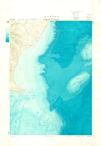
Chart No. 63627 Southwestern Part of Suruga Wan
Type
Map
Creator
Hydrographic Department, M.S.A.
Publisher
Maritime Safety Agency
Issued
1980
Issued (formated)
1980
Extent
63cm * 96cm
Description
コレクション: 国際地図・地理展(1980年・東京)
Reference number: JPN C-5-3
Explanation of the object (A): These are Bathymetric Charts in the 1:50,000 series of the "Basic Map of the Sea in Coastal Waters".
Map scale: 1:50,000
Map topic: Chart
Country / Region: Japan
Name of editor (b): Japan
Name of supervisor (c) : Japan
Name of printer (e): Naigai Chizu Co., Ltd.
Name of printer (e): Hydrographic Department, M.S.A.
Name of printer (e): JPY 950
Number of maps: 1
-
Faculty / Graduate SchoolCenter for Spacial Information Science
-
Data ProviderKashiwanoha Paper Maps Digital Archive Project, Center for Spatial Information Science, The University of Tokyo
-
Rightshttps://maparchive.csis.u-tokyo.ac.jp/browse/
-
Metadata Rightshttps://maparchive.csis.u-tokyo.ac.jp/browse/
Collection
-

Digital Map Collection [Center for Spacial Information Science]
This page contains maps from around the world that were collected for the International Cartographic and Geographical Exhibition held in conjunction with the International Geographic Congress & International Cartographic Conference in Japan in 1980 (1980 IGC-ICC). These maps are housed in the Kashiwa Library, the University of Tokyo and have been digitized and made publicly available through the Kashiwanoha Paper Maps Digital Archive Project.
share
関連資料
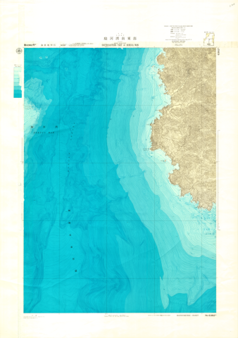
Chart No. 63626 Southeastern Part of Suruga Wan
Hydrographic Department, M.S.A.
Digital Map Collection [Center for Spacial Information Science] | Center for Spacial Information Science
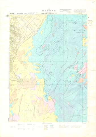
Chart No. 63627-S Southwestern Part of Suruga Wan
Hydrographic Department, M.S.A.
Digital Map Collection [Center for Spacial Information Science] | Center for Spacial Information Science
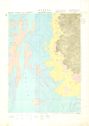
Chart No. 63626-S Southeastern Part of Suruga Wan
Hydrographic Department, M.S.A.
Digital Map Collection [Center for Spacial Information Science] | Center for Spacial Information Science
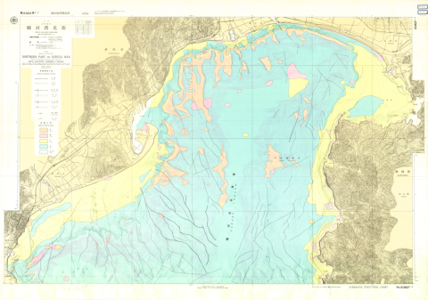
Chart No. 63625-S Northern Part of Suruga Wan
Hydrographic Department, M.S.A.
Digital Map Collection [Center for Spacial Information Science] | Center for Spacial Information Science
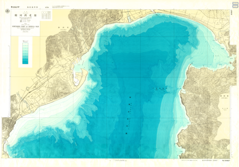
Chart No. 63625 Northern Part of Suruga Wan
Hydrographic Department, M.S.A.
Digital Map Collection [Center for Spacial Information Science] | Center for Spacial Information Science
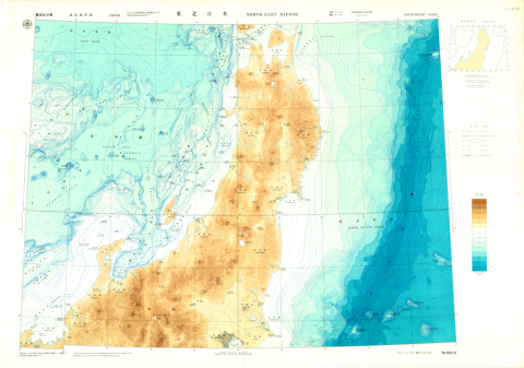
Chart No. 6312 North-East Nippon
Hydrographic Department, M.S.A.
Digital Map Collection [Center for Spacial Information Science] | Center for Spacial Information Science