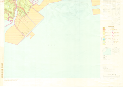
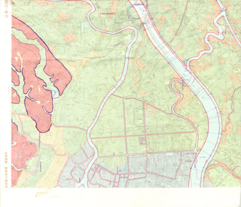
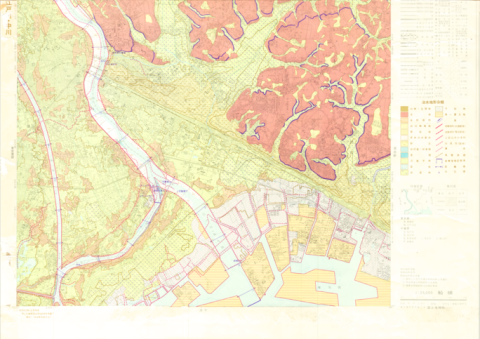
1:25,000 Landform Classification Map for Flood Control Planning (Urayasu)
Type
Map
Creator
Geographical Survey Institute
Extent
46cm * 58cm
Description
コレクション: 国際地図・地理展(1980年・東京)
Reference number: JPN C-17-6
Explanation of the object (A): The maps cover the lowland areas near the main rivers (104 rivers). 853 map sheets were completed from 1976 to 1979.
Map scale: 1:25,000
Country / Region: Japan
Name of editor (b): Japan
Name of supervisor (c) : Japan
Name of printer (e): not published
Name of printer (e): not published
Name of printer (e): not published
Number of maps: 1
-
Faculty / Graduate SchoolCenter for Spacial Information Science
-
Data ProviderKashiwanoha Paper Maps Digital Archive Project, Center for Spatial Information Science, The University of Tokyo
-
Rightshttps://maparchive.csis.u-tokyo.ac.jp/browse/
-
Metadata Rightshttps://maparchive.csis.u-tokyo.ac.jp/browse/
Collection
-

Digital Map Collection [Center for Spacial Information Science]
This page contains maps from around the world that were collected for the International Cartographic and Geographical Exhibition held in conjunction with the International Geographic Congress & International Cartographic Conference in Japan in 1980 (1980 IGC-ICC). These maps are housed in the Kashiwa Library, the University of Tokyo and have been digitized and made publicly available through the Kashiwanoha Paper Maps Digital Archive Project.
share
関連資料
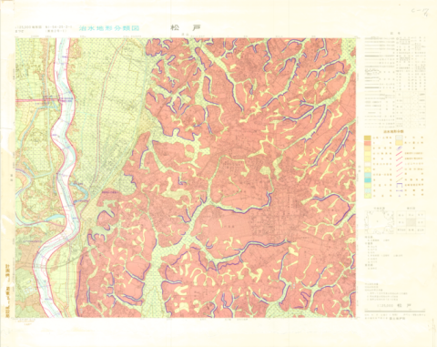
1:25,000 Landform Classification Map for Flood Control Planning (Matsudo)
Geographical Survey Institute
Digital Map Collection [Center for Spacial Information Science] | Center for Spacial Information Science
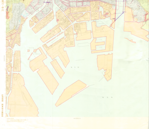
1:25,000 Landform Classification Map for Flood Control Planning (Southern Part of Tokyo)
Geographical Survey Institute
Digital Map Collection [Center for Spacial Information Science] | Center for Spacial Information Science
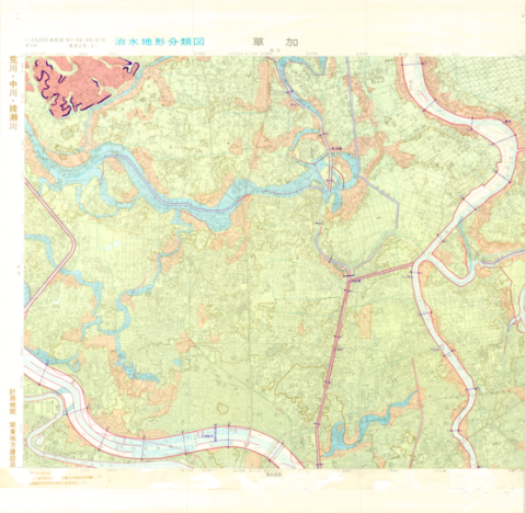
1:25,000 Landform Classification Map for Flood Control Planning (Soka)
Geographical Survey Institute
Digital Map Collection [Center for Spacial Information Science] | Center for Spacial Information Science
1:25,000 Landform Classification Map for Flood Control Planning (Main Part of Tokyo)
Geographical Survey Institute
Digital Map Collection [Center for Spacial Information Science] | Center for Spacial Information Science
1:25,000 Landform Classification Map for Flood Control Planning (Funabashi)
Geographical Survey Institute
Digital Map Collection [Center for Spacial Information Science] | Center for Spacial Information Science

1:25,000 scale Land Condition Map (Southeastern Part of Tokyo)
Geographical Survey Institute
Digital Map Collection [Center for Spacial Information Science] | Center for Spacial Information Science