
1:25,000 scale Land Use Map (Urayasu)
Geographical Survey Institute
柏の葉紙地図デジタルアーカイブ | 空間情報科学研究センター
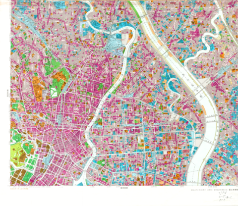
1:25,000 scale Land Use Map (Main Part of Tokyo)
Geographical Survey Institute
柏の葉紙地図デジタルアーカイブ | 空間情報科学研究センター

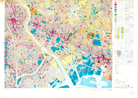
1:25,000 scale Land Use Map (Southern Part of Tokyo)
Geographical Survey Institute
柏の葉紙地図デジタルアーカイブ | 空間情報科学研究センター

1:25,000 scale Land Use Map (Soka)
Geographical Survey Institute
柏の葉紙地図デジタルアーカイブ | 空間情報科学研究センター
1:25,000 scale Land Use Map (Funabashi)
Geographical Survey Institute
柏の葉紙地図デジタルアーカイブ | 空間情報科学研究センター
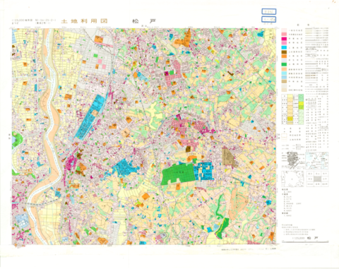
1:25,000 scale Land Use Map (Matsudo)
Geographical Survey Institute
柏の葉紙地図デジタルアーカイブ | 空間情報科学研究センター
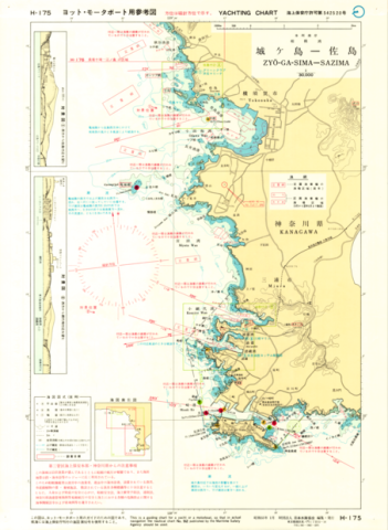
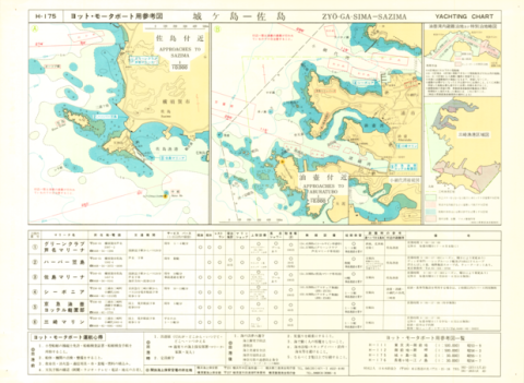
Yachting Charts - Coastal Sailing Series H-175 Zyo-ga-Sima - Sazima 1:30,000 - Front
Japan Hydrographic Association
柏の葉紙地図デジタルアーカイブ | 空間情報科学研究センター
Yachting Charts - Coastal Sailing Series H-175 Zyo-ga-Sima - Sazima 1:30,000 - Back
Japan Hydrographic Association
柏の葉紙地図デジタルアーカイブ | 空間情報科学研究センター

Chart No. 4054 (INT 53) North Pacific Ocean - Northwestern Portion 1:10,000,000 (Lat. 0°)
Hydrographic Department, M.S.A.
柏の葉紙地図デジタルアーカイブ | 空間情報科学研究センター
童子教稚繪解 ; (上) / 笠亭主人註釈 ; 五雲亭貞秀畫
五雲亭貞秀畫, 笠亭主人註釈
富士川文庫 | 教育学研究科・教育学部