
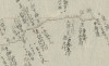
[26]第四番 : 自白川至矢吹六分圖 , 第五番 : 自矢吹至清水町圖
Language
Japanese
Type
StillImage
Extent
93枚
Description
資料名:測地原圖
その他の資料名:測地原稿図
その他の資料名よみ:そくちげんこうず
その他の資料名:伊能図
その他の資料名よみ:いのうず
その他の資料名:第4番 自 白川 至 矢吹, 第5番 自 矢吹 至 清水町図
請求記号:A00:4549
刊写の別:写
-
Faculty / Graduate SchoolGeneral Library
-
Original OwnerGeneral Library, The University of Tokyo
-
Data ProviderGeneral Library, The University of Tokyo
-
Rightshttps://www.lib.u-tokyo.ac.jp/ja/library/general/reuse

-
Metadata Rightshttps://creativecommons.org/publicdomain/zero/1.0/

-
IIIF manifesthttps://da.dl.itc.u-tokyo.ac.jp/portal/repo/iiif/f2c3ea81-1462-3963-1747-6692f3cb29fa/manifest
Collection
-
Sokuchi genzu
The geodetic maps "Sokuchi-Genzu" are a group of maps that describe the results of surveys carried out by Ino Tadataka (1745-1818) in the early 19th century, also known as ‘Ino maps’.
share
関連資料
[21]西国街道四 : 従岡山下町至神辺又油木八川ニ至ル : 六分一里之図
Sokuchi genzu | General Library
[25]第卅八番 : 自唐舟至岩尻村圖
Sokuchi genzu | General Library
[24]第三十七番 : 自田老村至唐丹之圖
Sokuchi genzu | General Library
[4]自江府深川測処至大堀村 : 㐧一圖之内猫実 : 六分一里の圖
Sokuchi genzu | General Library
[35]九州第十五 : 自串木野五反川至薩肥国境
Sokuchi genzu | General Library
[34]九州第十四 : 自御領村石垣浦至串木野五反川 : 附肥後街道清藤村ゟ市来湊迠
Sokuchi genzu | General Library
