
Chart No. 749. Singapore Strait, Eastern Portion. 1:75,000 (Lat. 1°15')
Hydrographic Department, M.S.A.
柏の葉紙地図デジタルアーカイブ | 空間情報科学研究センター

Chart No. 750. Singapore Strait, Central Portion. 1:50,000 (Lat. 1°15')
Hydrographic Department, M.S.A.
柏の葉紙地図デジタルアーカイブ | 空間情報科学研究センター

Chart No. 751. Singapore Strait, Western Portion. 1:50,000 (Lat. 1°15')
Hydrographic Department, M.S.A.
柏の葉紙地図デジタルアーカイブ | 空間情報科学研究センター
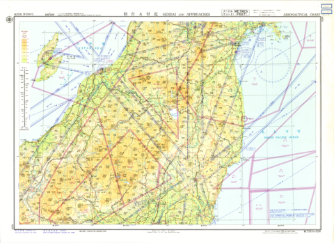
Aeronautical Chart No. 8293, Sendai and Approaches, 1:500,000
Hydrographic Department, M.S.A.
柏の葉紙地図デジタルアーカイブ | 空間情報科学研究センター
Aeronautical Chart No. 8293, Sendai and Approaches, 1:500,000
Hydrographic Department, M.S.A.
柏の葉紙地図デジタルアーカイブ | 空間情報科学研究センター

1:40,000 scale Map Showing Process of Urbanization "Tutiura"
Geographical Survey Institute
柏の葉紙地図デジタルアーカイブ | 空間情報科学研究センター
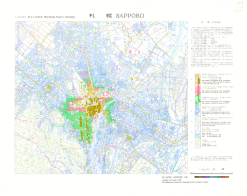
1:40,000 scale Map Showing Process of Urbanization "Sapporo"
Geographical Survey Institute
柏の葉紙地図デジタルアーカイブ | 空間情報科学研究センター
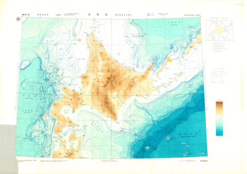
Chart No. 6311 Hokkaido
Hydrographic Department, M.S.A.
柏の葉紙地図デジタルアーカイブ | 空間情報科学研究センター
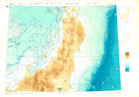
Chart No. 6312 North-East Nippon
Hydrographic Department, M.S.A.
柏の葉紙地図デジタルアーカイブ | 空間情報科学研究センター

1:25,000 scale Land Condition Map (Northeastern Part of Tokyo)
Geographical Survey Institute
柏の葉紙地図デジタルアーカイブ | 空間情報科学研究センター

1:25,000 scale Land Condition Map (Southeastern Part of Tokyo)
Geographical Survey Institute
柏の葉紙地図デジタルアーカイブ | 空間情報科学研究センター
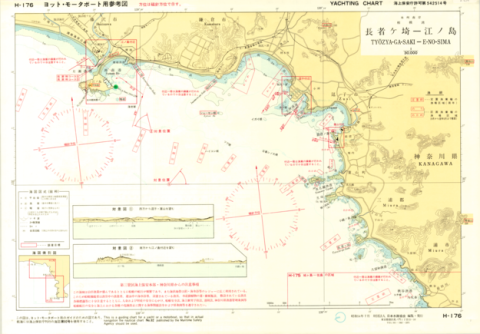
Yachting Charts - Coastal Sailing Series H-176 Tyozya-ga-Saki - E-no-Sima 1:30,000 - Front
Japan Hydrographic Association
柏の葉紙地図デジタルアーカイブ | 空間情報科学研究センター
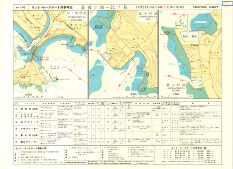
Yachting Charts - Coastal Sailing Series H-176 Tyozya-ga-Saki - E-no-Sima 1:30,000 - Back
Japan Hydrographic Association
柏の葉紙地図デジタルアーカイブ | 空間情報科学研究センター
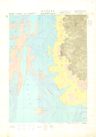
Chart No. 63626-S Southeastern Part of Suruga Wan
Hydrographic Department, M.S.A.
柏の葉紙地図デジタルアーカイブ | 空間情報科学研究センター
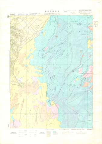
Chart No. 63627-S Southwestern Part of Suruga Wan
Hydrographic Department, M.S.A.
柏の葉紙地図デジタルアーカイブ | 空間情報科学研究センター
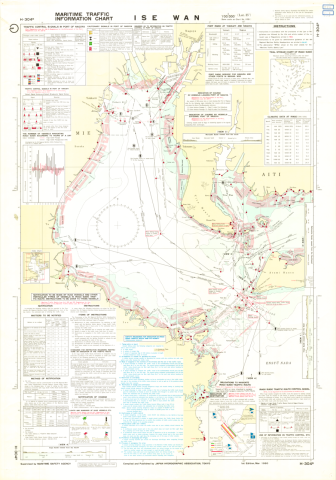
Maritime Traffic Information Charts H-304B Ise Wan 1:100,000 (Lat. 35°)
Japan Hydrographic Association
柏の葉紙地図デジタルアーカイブ | 空間情報科学研究センター
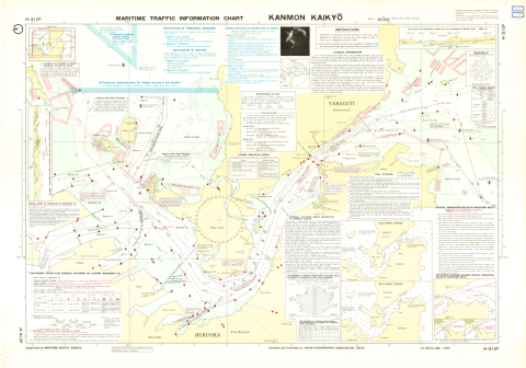
Maritime Traffic Information Charts H-310B Kanmon Kaikyo 1:23,000
Japan Hydrographic Association
柏の葉紙地図デジタルアーカイブ | 空間情報科学研究センター
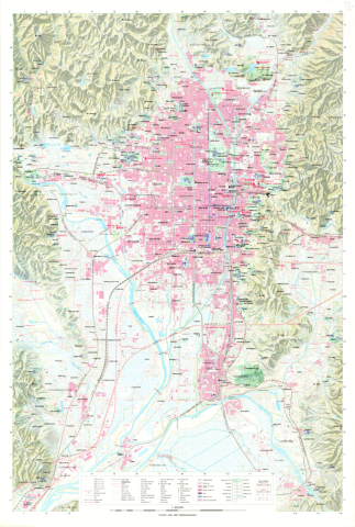
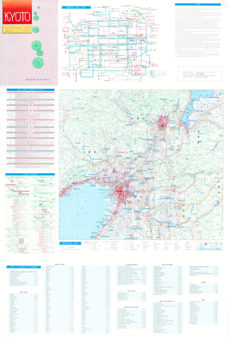
1:25,000 Kyoto and Her Surroundings (English edition)
Geographical Survey Institute
柏の葉紙地図デジタルアーカイブ | 空間情報科学研究センター
1:25,000 Kyoto and Her Surroundings (English edition) Revers side
Geographical Survey Institute
柏の葉紙地図デジタルアーカイブ | 空間情報科学研究センター
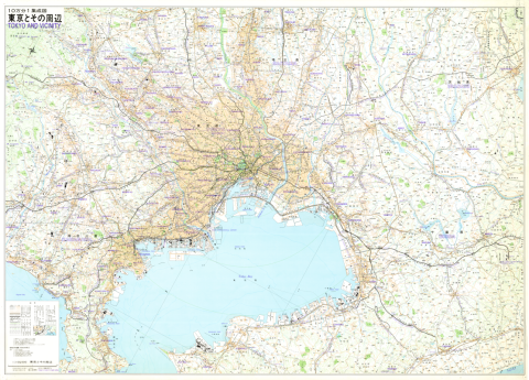
1:100,000 Tokyo and Vicinity (English edition)
Geographical Survey Institute
柏の葉紙地図デジタルアーカイブ | 空間情報科学研究センター