
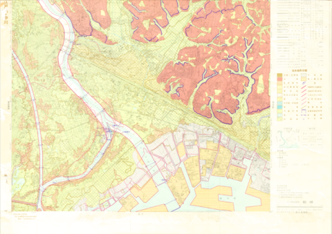
1:25,000 scale Land Condition Map of Coastal Area (Gamagori)
Geographical Survey Institute
柏の葉紙地図デジタルアーカイブ | 空間情報科学研究センター
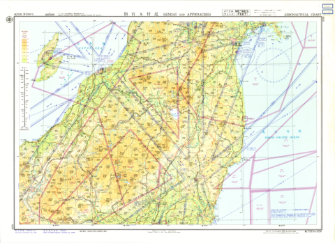
Aeronautical Chart No. 8293, Sendai and Approaches, 1:500,000
Hydrographic Department, M.S.A.
柏の葉紙地図デジタルアーカイブ | 空間情報科学研究センター
Aeronautical Chart No. 8293, Sendai and Approaches, 1:500,000
Hydrographic Department, M.S.A.
柏の葉紙地図デジタルアーカイブ | 空間情報科学研究センター

1:40,000 scale Map Showing Process of Urbanization "Tutiura"
Geographical Survey Institute
柏の葉紙地図デジタルアーカイブ | 空間情報科学研究センター
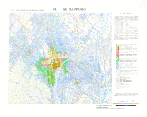
1:40,000 scale Map Showing Process of Urbanization "Sapporo"
Geographical Survey Institute
柏の葉紙地図デジタルアーカイブ | 空間情報科学研究センター
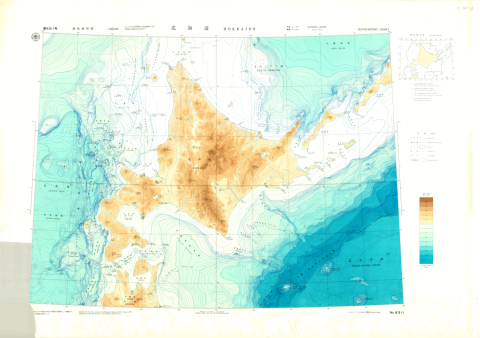
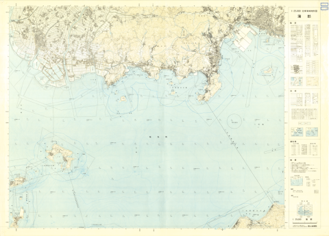
Chart No. 6311 Hokkaido
Hydrographic Department, M.S.A.
柏の葉紙地図デジタルアーカイブ | 空間情報科学研究センター
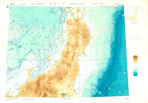
Chart No. 6312 North-East Nippon
Hydrographic Department, M.S.A.
柏の葉紙地図デジタルアーカイブ | 空間情報科学研究センター
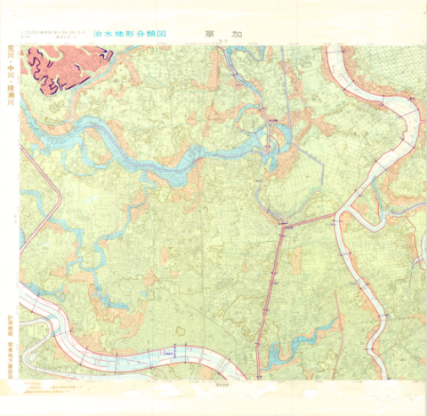
1:25,000 Landform Classification Map for Flood Control Planning (Soka)
Geographical Survey Institute
柏の葉紙地図デジタルアーカイブ | 空間情報科学研究センター
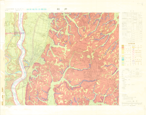
1:25,000 Landform Classification Map for Flood Control Planning (Matsudo)
Geographical Survey Institute
柏の葉紙地図デジタルアーカイブ | 空間情報科学研究センター
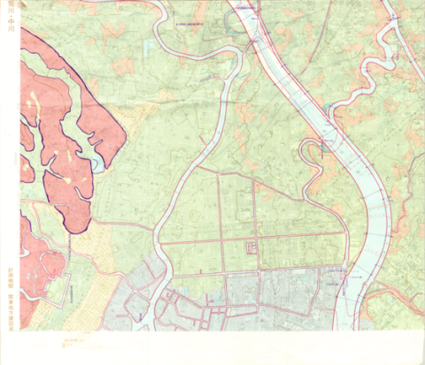
1:25,000 Landform Classification Map for Flood Control Planning (Main Part of Tokyo)
Geographical Survey Institute
柏の葉紙地図デジタルアーカイブ | 空間情報科学研究センター
1:25,000 Landform Classification Map for Flood Control Planning (Funabashi)
Geographical Survey Institute
柏の葉紙地図デジタルアーカイブ | 空間情報科学研究センター
1:25,000 Landform Classification Map for Flood Control Planning (Urayasu)
Geographical Survey Institute
柏の葉紙地図デジタルアーカイブ | 空間情報科学研究センター
1:25,000 Landform Classification Map for Flood Control Planning (Southern Part of Tokyo)
Geographical Survey Institute
柏の葉紙地図デジタルアーカイブ | 空間情報科学研究センター
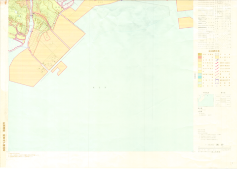
1:25000 scale Topographical Map of Coastal Area (Gamagori)
Geographical Survey Institute
柏の葉紙地図デジタルアーカイブ | 空間情報科学研究センター

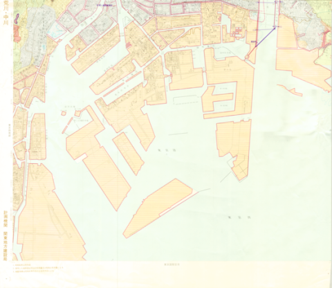
1:25,000 scale Land Use Map (Urayasu)
Geographical Survey Institute
柏の葉紙地図デジタルアーカイブ | 空間情報科学研究センター
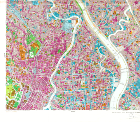
1:25,000 scale Land Use Map (Main Part of Tokyo)
Geographical Survey Institute
柏の葉紙地図デジタルアーカイブ | 空間情報科学研究センター

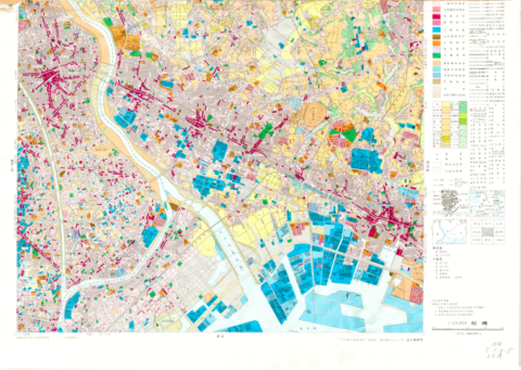
1:25,000 scale Land Use Map (Southern Part of Tokyo)
Geographical Survey Institute
柏の葉紙地図デジタルアーカイブ | 空間情報科学研究センター

1:25,000 scale Land Use Map (Soka)
Geographical Survey Institute
柏の葉紙地図デジタルアーカイブ | 空間情報科学研究センター
1:25,000 scale Land Use Map (Funabashi)
Geographical Survey Institute
柏の葉紙地図デジタルアーカイブ | 空間情報科学研究センター

1:25,000 scale Land Condition Map (Northeastern Part of Tokyo)
Geographical Survey Institute
柏の葉紙地図デジタルアーカイブ | 空間情報科学研究センター