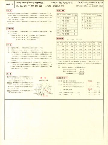
Yachting Charts - Offshore Sailing Series H-111 Tokyo Wan - Omae Saki 1:500,000 (Lat. 35°)
Japan Hydrographic Association
柏の葉紙地図デジタルアーカイブ | 空間情報科学研究センター
1:25,000 Kyoto and Her Surroundings (English edition)
Geographical Survey Institute
柏の葉紙地図デジタルアーカイブ | 空間情報科学研究センター
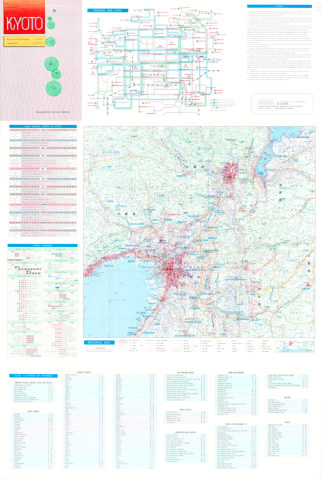
1:25,000 Kyoto and Her Surroundings (English edition) Revers side
Geographical Survey Institute
柏の葉紙地図デジタルアーカイブ | 空間情報科学研究センター
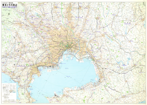
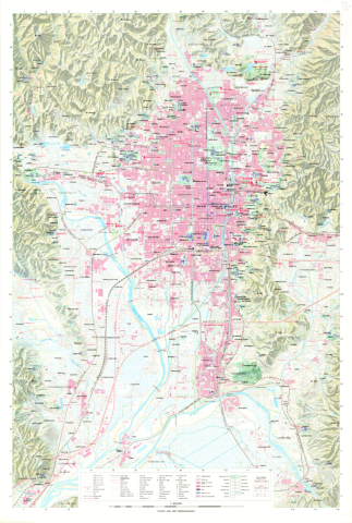
1:100,000 Tokyo and Vicinity (English edition)
Geographical Survey Institute
柏の葉紙地図デジタルアーカイブ | 空間情報科学研究センター
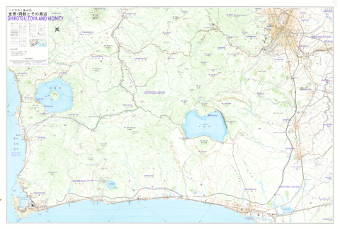
1:100,000 Shikotsu, Toya and Vicinity (English edition)
Geographical Survey Institute
柏の葉紙地図デジタルアーカイブ | 空間情報科学研究センター

Chart No. 4054 (INT 53) North Pacific Ocean - Northwestern Portion 1:10,000,000 (Lat. 0°)
Hydrographic Department, M.S.A.
柏の葉紙地図デジタルアーカイブ | 空間情報科学研究センター
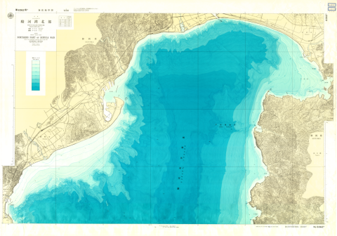
Chart No. 63625 Northern Part of Suruga Wan
Hydrographic Department, M.S.A.
柏の葉紙地図デジタルアーカイブ | 空間情報科学研究センター
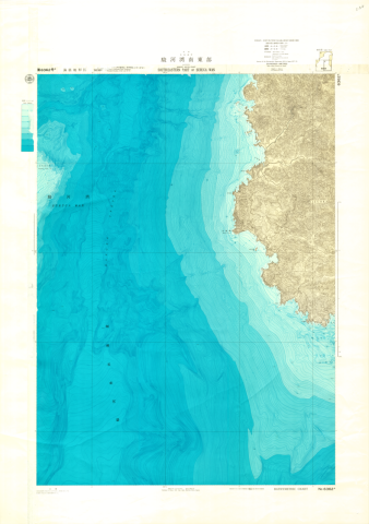
Chart No. 63626 Southeastern Part of Suruga Wan
Hydrographic Department, M.S.A.
柏の葉紙地図デジタルアーカイブ | 空間情報科学研究センター
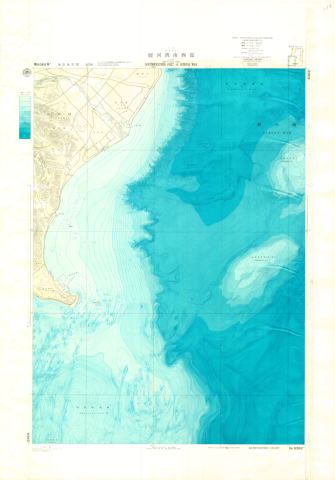
Chart No. 63627 Southwestern Part of Suruga Wan
Hydrographic Department, M.S.A.
柏の葉紙地図デジタルアーカイブ | 空間情報科学研究センター